Experiments in geography education using twitter
Ryan Kirk, Assistant Professor of Geography and Environmental Studies
Twitter added an opt-in geolocation option to Tweets in 2009. Current estimate are that between 1-10% of Tweets include location, but location can also be determined by user metadata if you enter a "Location" on your profile or if you provide information about your location within the Tweet text. A large variety of researchers are exploring these "geotweets." Prominent examples include the "Geography of Hate" project and the insightful (and often entertaining) analysis from the Floating Sheep gang. Other example applications being explored include publich health, psycho-social dynamics of groups, linguistics, and disaster management. This page documents a few experiments exploring the use of geotweets for Geography education.
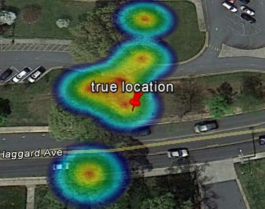
1) Location Accuracy Assessment
Using my iPhone 4s, I've been sending geotweets at the location of Geodetic Survey Marks on campus. Formal accuracy assessment forthcoming.
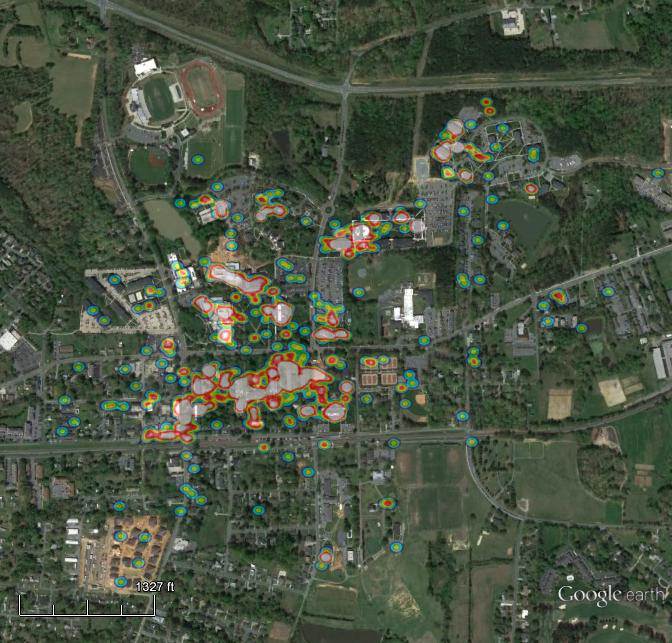
2) Community mapping using Twitter
Students can monitor where they go in a community to consider how they interact with that community and how their movements bias their understanding of the community. Students are piloting this in Spring 2014.
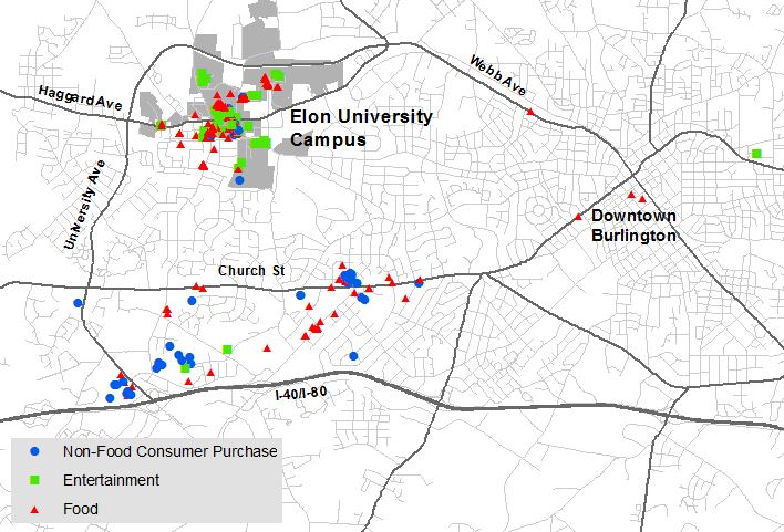
3) Consumer behavior analysis
Students in a 100-level course that explores spatial technologies used Twitter and ArcGIS to map and analyze college student consumer behaviors over a 1-month period.
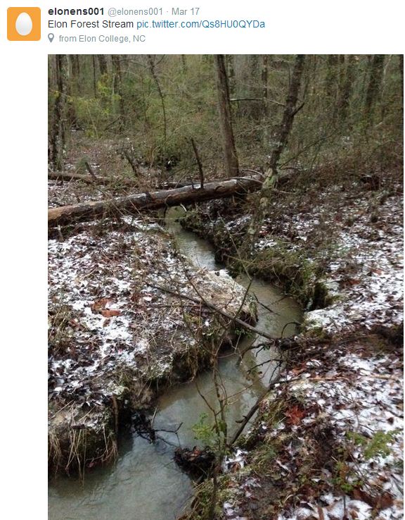
4) Field Data Collection
Students and other field researchers can add pictures and measurements to Tweets for a quick and permanent record that automatically includes the date, time, and location of the site. Here is an example of a student conducting water sampling, so we now have a photo record of site conditions along with the measurement values.
Note on Processing Tools:
There are lots of nice tools for processing Tweets to map and evaluate locations. For mapping location of Tweets, two tools that initially got my interest were geosocialfootprint.com and tweetedtrips.com. However, I've since opted to write my own scripts to archive and analyze Tweets using Python. Tweepy is a sleek package for quickly searching and downloading Tweets (I just save them to csv rather than a database). Simplekml is an excellent package for converting point coordinates to kml files for use in Google Earth. Heatmap is a very easy way to generate heat maps of point densities and produces kml & png outputs that can be opened right in Google Earth. Thanks to all these developers for their great tools!